Publishing date: 27/09/2024
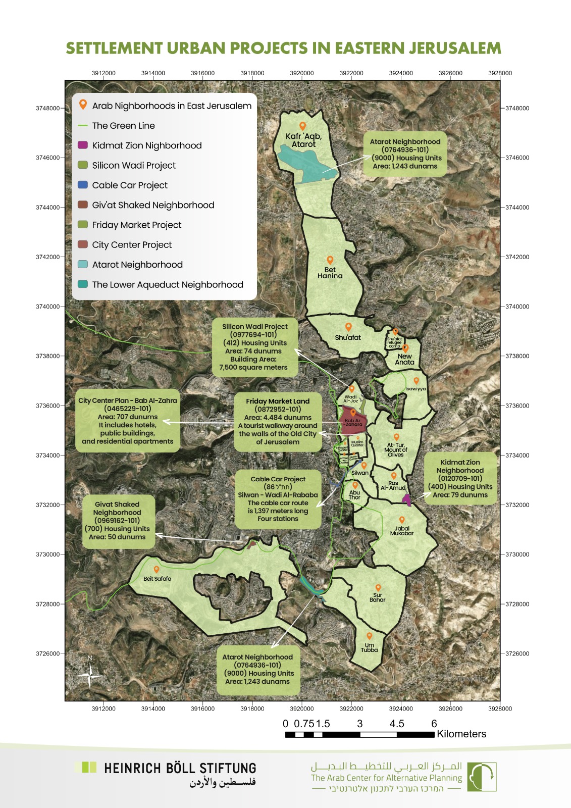
This page contains an interactive map (GIS) including demographical and planning data regarding East Jerusalem neighborhoods. The map also contains information about plans initiated by different Israeli organizations.
You can point on a specific neighborhood and a window shownig the data wil automatically open. You can zoom in and out by clicking on + -.
You can also click on the top left Arrows to pick more data, informations, and maps.